")
Trail runners… were you ready to move on? Forget it. The UTDS is back. And it’s back with a bang.? Taken over by a new team (The Next Venture), with
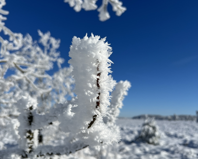
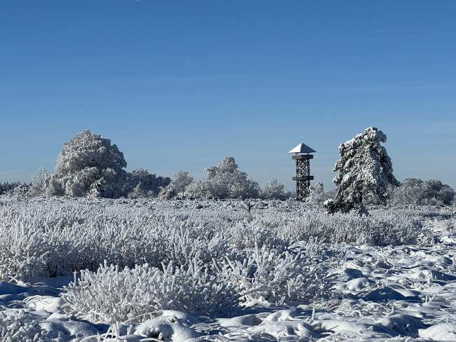
Immersion in the Pays des Sources (Ardennes)
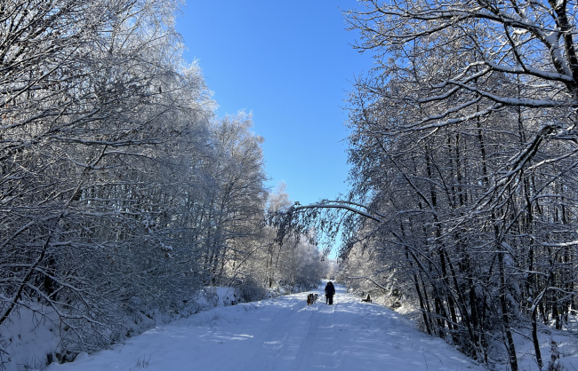
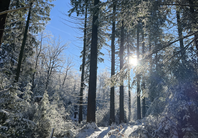
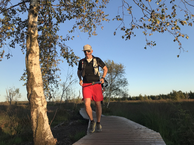
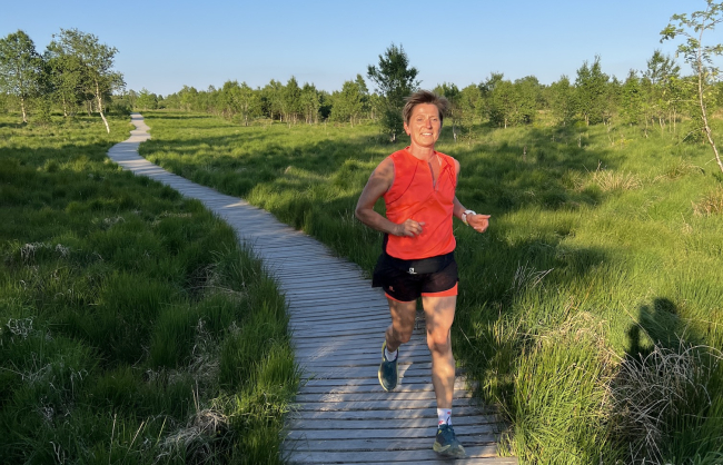
TRAILRUNNING: A THOUSAND WAYS TO GET AWAY
Offering a solid infrastructure, allowing the Trail to be run in a safe way, through carefully selected paths, while strengthening its attractiveness to tourists throughout a region (Belgian Ardennes), is what ExtraTrail is proposing.
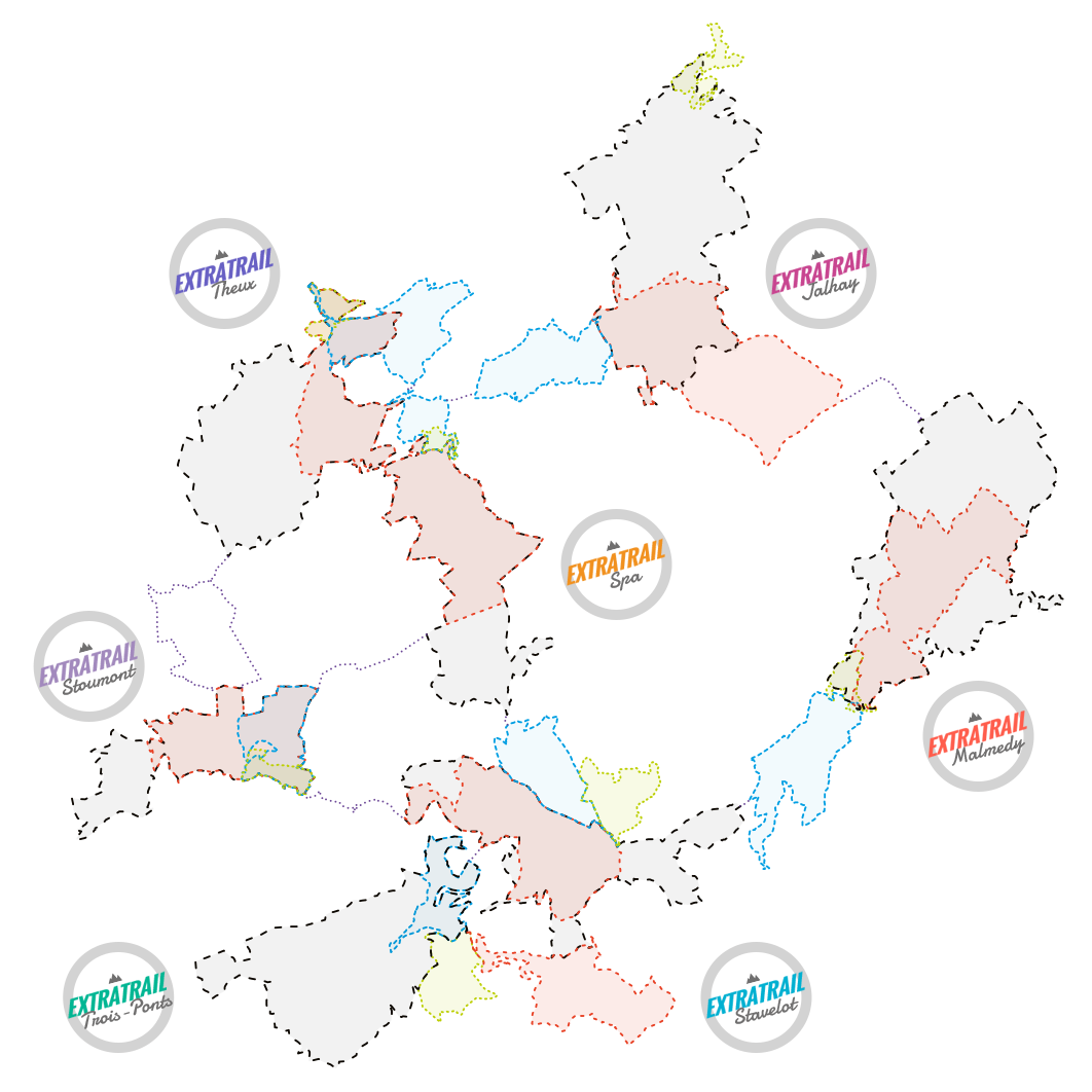
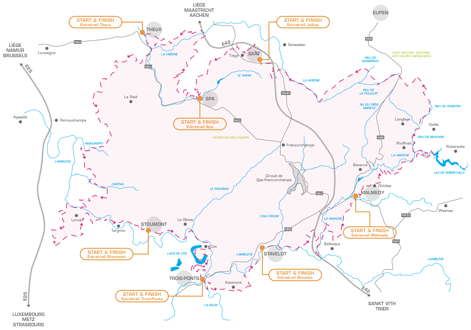
EXTRATRAIL: a tangible response to a real demand.
With 30 permanent routes over more than 750 KM and 22,000 m of positive elevation, Extratrail is one of the largest networks of nature trails in Europe.
Each route begins at the Tourist Information Offices in the participating Belgian towns and communes (Spa, Stoumont (public library), Jalhay, Stavelot, Theux, Trois-Ponts & Malmedy).
28
marked
trails
1
ultra
trail
1
vertical
track
750 km
marked
kilometers
7
interconnected
municipalities
22.000 m
meters elevation
Our permanent marked trails
select aN AREA
Image
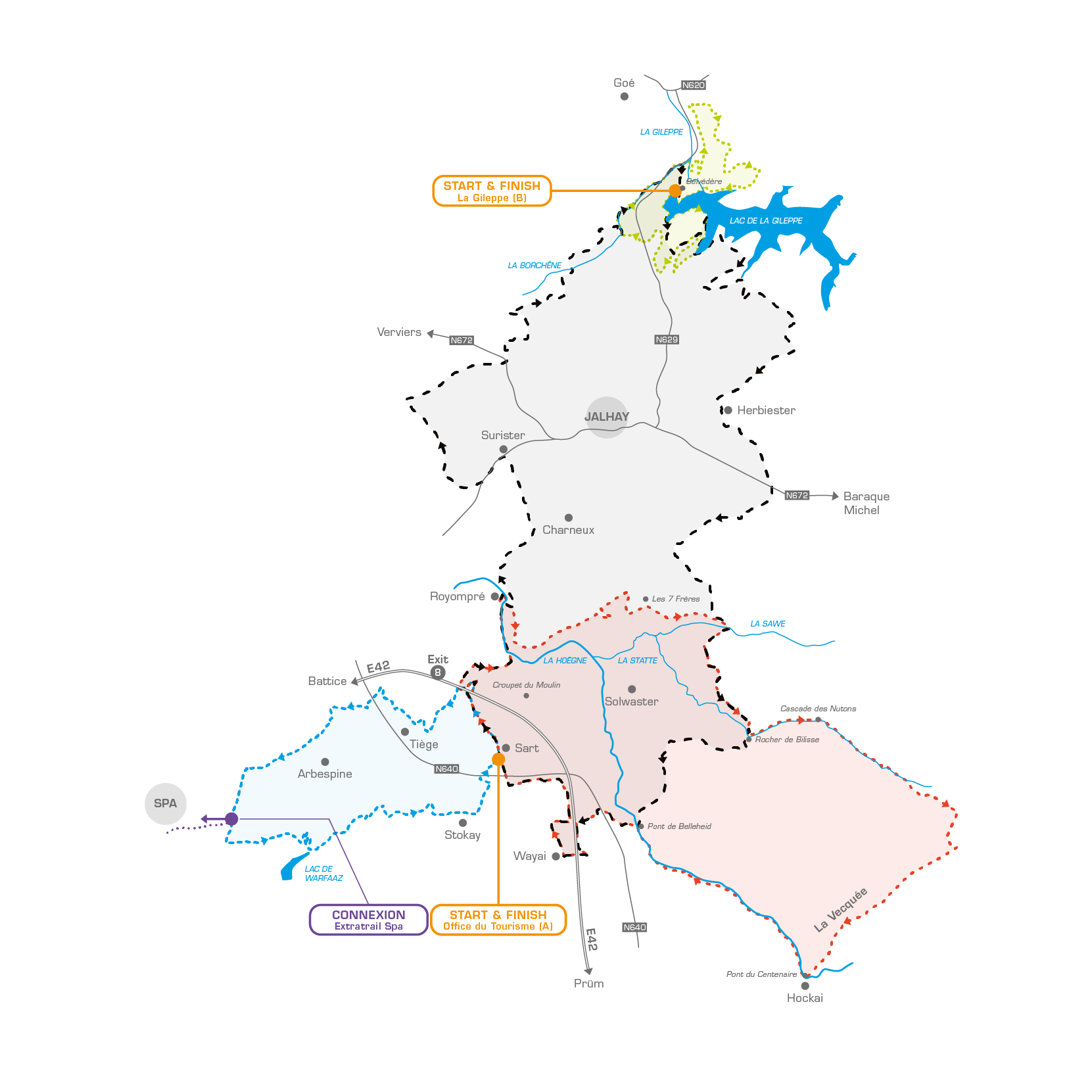
ExtraTrail Jalhay
Green trail
Blue trail
Distance
13,2 km
Incline +
275 m
Duration 1,25 to 2,5 hours
Difficulty ++
Start
Place du Marché - Sart-lez-Spa
Red trail
Distance
25,8 km
Incline +
535 m
Duration 2,5 to 4,5 hours
Difficulty +++
Start
Place du Marché - Sart-lez-Spa
Black trail
Distance
40 km
Incline +
765 m
Duration 4 to 6 hours
Difficulty ++++
Start
Place du Marché - Sart-lez-Spa or La Gileppe car park
Image
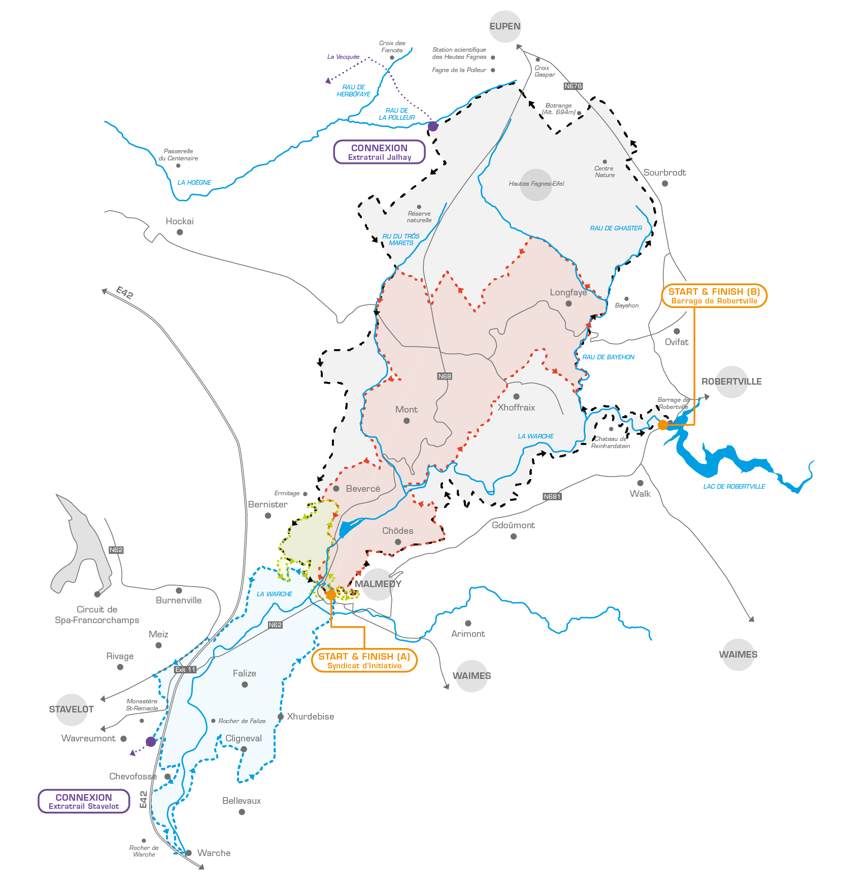
ExtraTrail Malmedy
Green trail
Distance
8 km
Incline +
310 m
Duration 1 to 2,5 hours
Difficulty ++
Start
Town centre (Malmundarium - Tourist Office)
Blue trail
Distance
18 km
Incline +
492 m
Duration 2 to 3,5 hours
Difficulty ++
Start
Town centre (Malmundarium - Tourist Office)
Red trail
Distance
27 km
Incline +
740 m
Duration 3 to 5 hours
Difficulty +++
Start
Town centre (Malmundarium - Tourist Office)
Black trail
Distance
39 km
Incline +
985 m
Duration 5 to 8 hours
Difficulty ++++
Start
A: Town centre (Malmundarium - Tourist Office)
B: Lake Robertville dam
Image
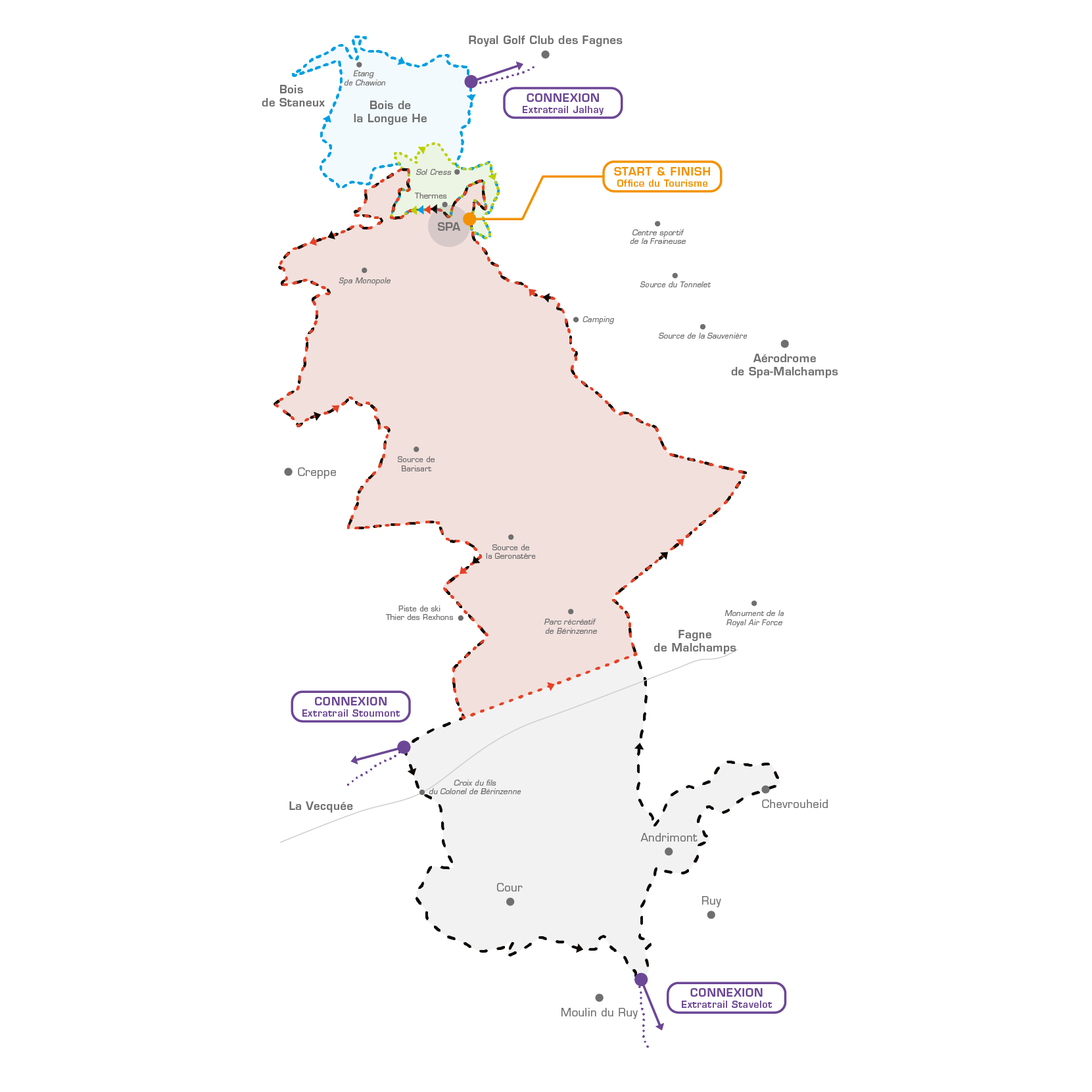
ExtraTrail Spa
Green trail
Distance
5 km
Incline +
235 m
Duration 45 minutes to 1,5 hours
Difficulty ++
Start
Tourist Office
Blue trail
Distance
10 km
Incline +
368 m
Duration 1 to 2 hours
Difficulty +++
Start
Tourist Office
Red trail
Distance
22 km
Incline +
650 m
Duration 2,5 to 4 hours
Difficulty +++
Start
Tourist Office
Black trail
Distance
32 km
Incline +
1000 m
Duration 4 to 6 hours
Difficulty +++++
Start
Tourist Office
Image
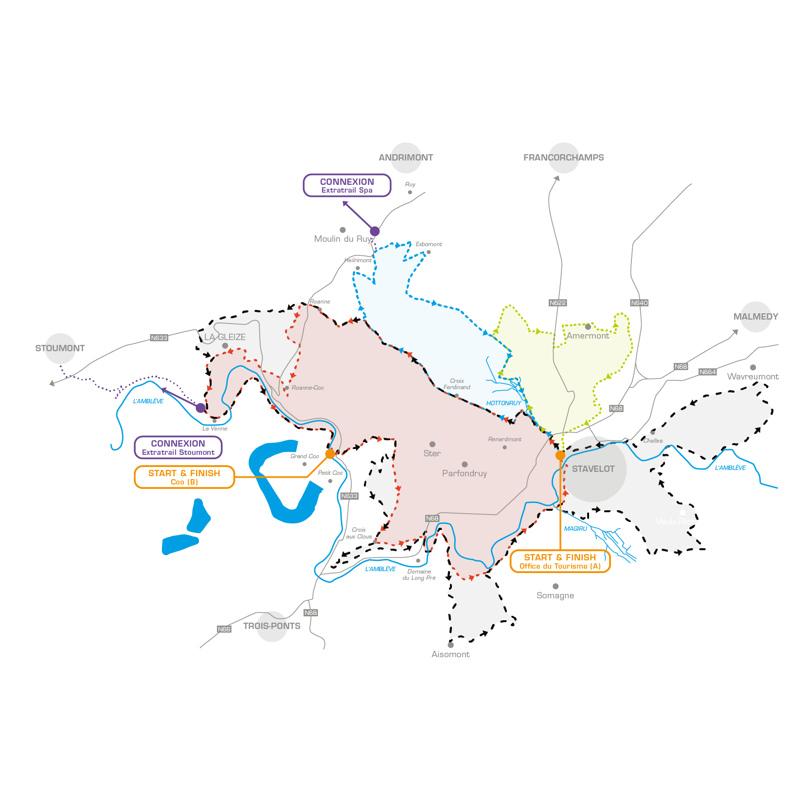
ExtraTrail Stavelot
Green trail
Distance
9,8 km
Incline +
270 m
Duration 1 to 2,5 hours
Difficulty ++
Start
Tourism Office (Stavelot Abbey)
Blue trail
Distance
13,5 km
Incline +
478 m
Duration 1,5 to 2,5 hours
Difficulty +++
Start
Tourist office (Stavelot Abbey) Note: significant proportion of paved area
Red trail
Distance
23 km
Incline +
830 m
Duration 2,5 to 5 hours
Difficulty ++++
Start
Tourist office (Stavelot Abbey) and Coo Syndicat d’initiatives
Black trail
Distance
40 km
Incline +
1340 m
Duration 4,5 to 7 hours
Difficulty +++++
Start
Tourist Office (Stavelot Abbey) and Coo Syndicat d’initiatives
Image
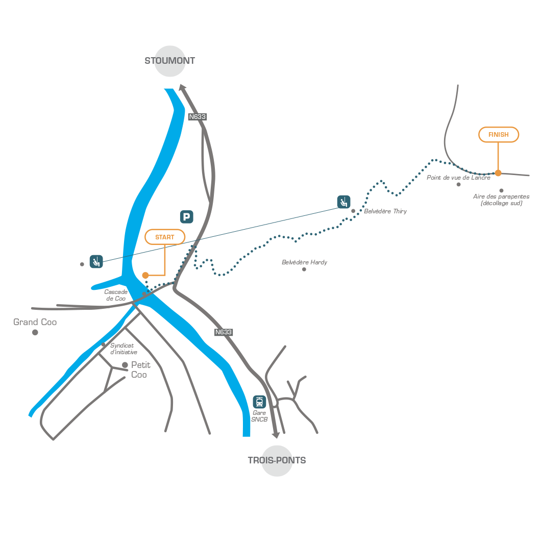
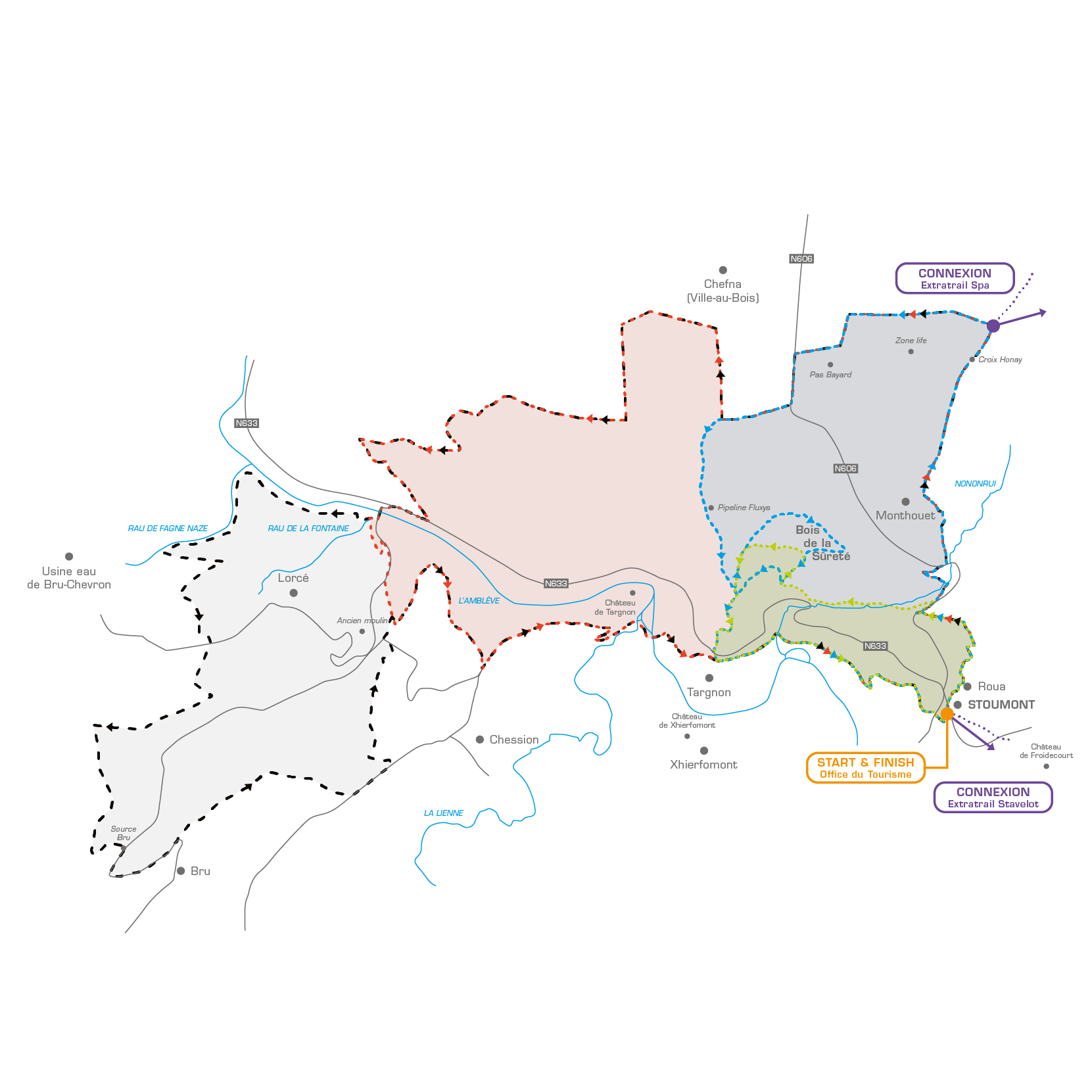
ExtraTrail Stoumont
Green trail
Distance
6,9 km
Incline +
328 m
Duration 40 min. to 1,5 hours
Difficulty ++
Start
Public library - Route de l'Amblève 45 - 4987 Stoumont
Blue trail
Distance
14 km
Incline +
438 m
Duration 1,5 to 2,5 hours
Difficulty +++
Start
Public library - Route de l'Amblève 45 - 4987 Stoumont
Red trail
Distance
21 km
Incline +
638 m
Duration 2 to 4 hours
Difficulty ++++
Start
Public library - Route de l'Amblève 45 - 4987 Stoumont
Black trail
Distance
30 km
Incline +
967 m
Duration 4 to 7 hours
Difficulty +++++
Start
Public library - Route de l'Amblève 45 - 4987 Stoumont
Image
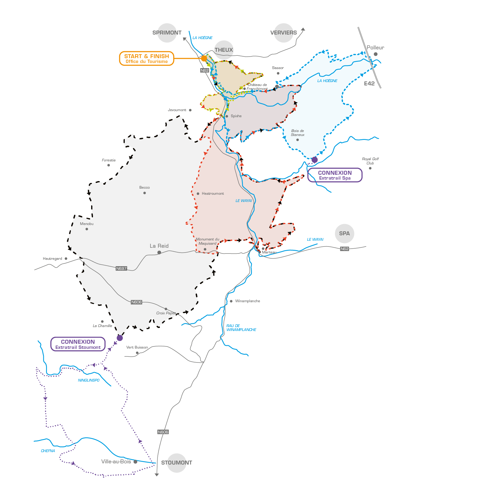
ExtraTrail Theux
Green trail
Distance
8 km
Incline +
331 m
Duration 1 to 2,5 hours
Difficulty ++
Start
Town center
Blue trail
Distance
18 km
Incline +
513 m
Duration 2 to 3,5 hours
Difficulty ++
Start
Town center
Red trail
Distance
26 km
Incline +
880 m
Duration 2,5 to 5 hours
Difficulty +++
Start
Town center
Black trail
Distance
37 km
Incline +
870 m
Duration 3,5 to 7 hours
Difficulty ++++
Start
Town center
Image
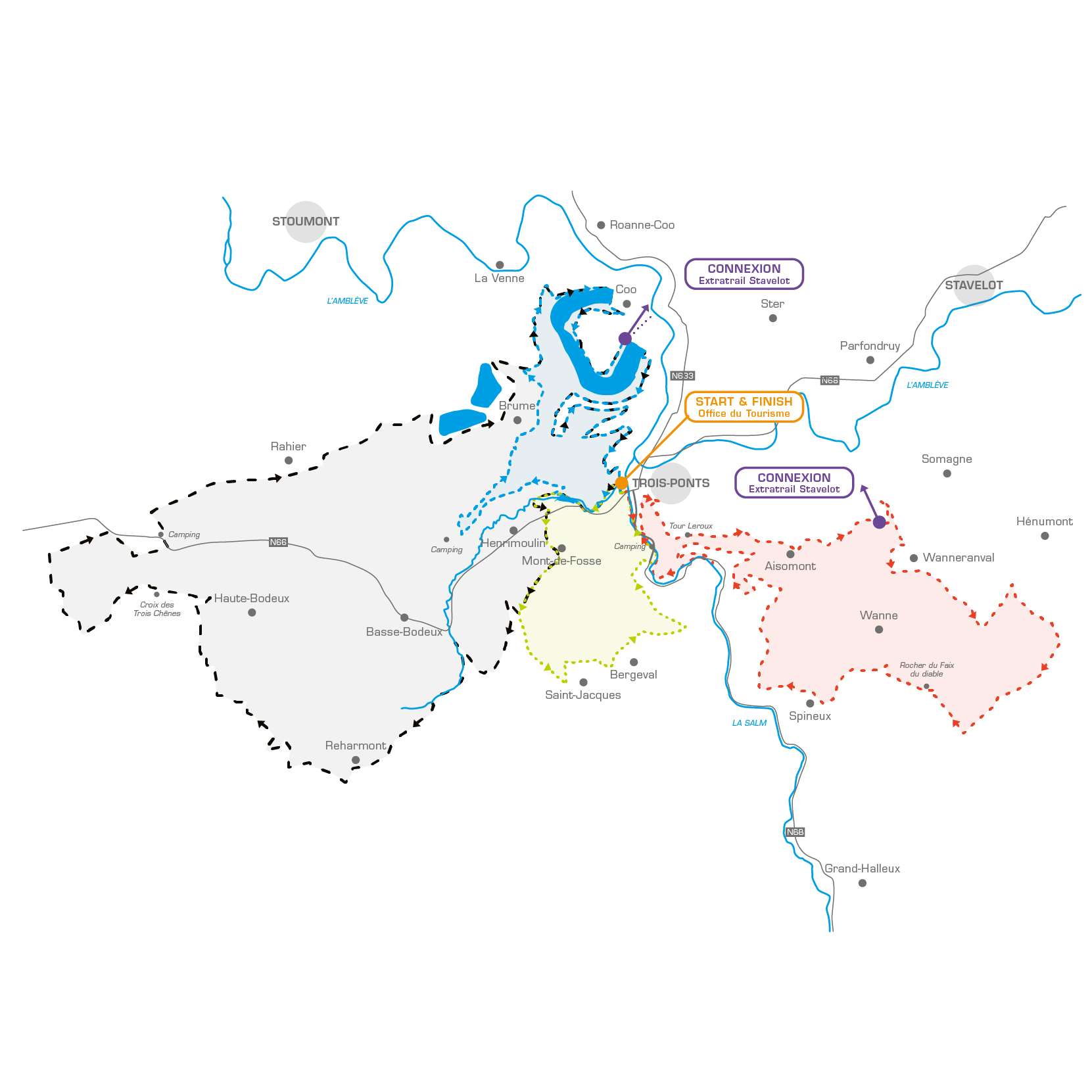
ExtraTrail Trois-Ponts
Green trail
Distance
10 km
Incline +
315 m
Duration 1 to 2,5 hours
Difficulty ++
Start
Trois-Ponts tourist information office
Blue trail
Distance
17 km
Incline +
680 m
Duration 1,5 to 3 hours
Difficulty +++
Start
Trois-Ponts tourist information office
Red trail
Distance
23 km
Incline +
700 m
Duration 2 to 4 hours
Difficulty +++
Start
Trois-Ponts tourist information office
Black trail
Distance
37 km
Incline +
1020 m
Duration 3,5 to 7 hours
Difficulty ++++
Start
Trois-Ponts tourist information office
Image
ExtraTrail UTDS
Distance
157 km
Incline +
4140 m
Duration 20 hours - 5 days
Difficulty +++++
Start
- Spa Tourist Information Office (city centre)
- Stoumont Public library (centre of the village)
- Jalhay-Sart Tourist Information Office (Place de Sart)
- Stavelot Tourist Information Centre (city centre - abbey)
- Theux Tourist Information Office (city centre)
- Trois-Ponts Tourist Information Office (city centre)
- Malmedy Tourist Information Office (city centre - Malmundarium)
- Robertville dam car park (Waimes)
Image
FALLEN TREE? MISSING MARKER? HUNT IN PROGRESS?
REPORT A PROBLEM ON OUR TRAILS!
Single Track
latest news on our trails
Actualités


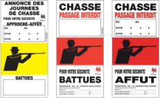
GOOD TO KNOW
Hunting info
Never use the trail if access is prohibited by special markers.
Official yellow signs are signs that display information and advise caution.
Official red signs are signs that prohibit the use of a trail or path.
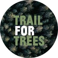
Trail for trees
A second breath for the planet
Are you passionate about trail? Nature inspires you and you find in it essential resources for your personal balance? “Trail For Trees” is a video series made for you!
Content available in French only.
ExtraTrail in pictures
DISCOVER OUR PHOTOS & VIDEOS
Partners
In the same STRIDE
Partenaire promu